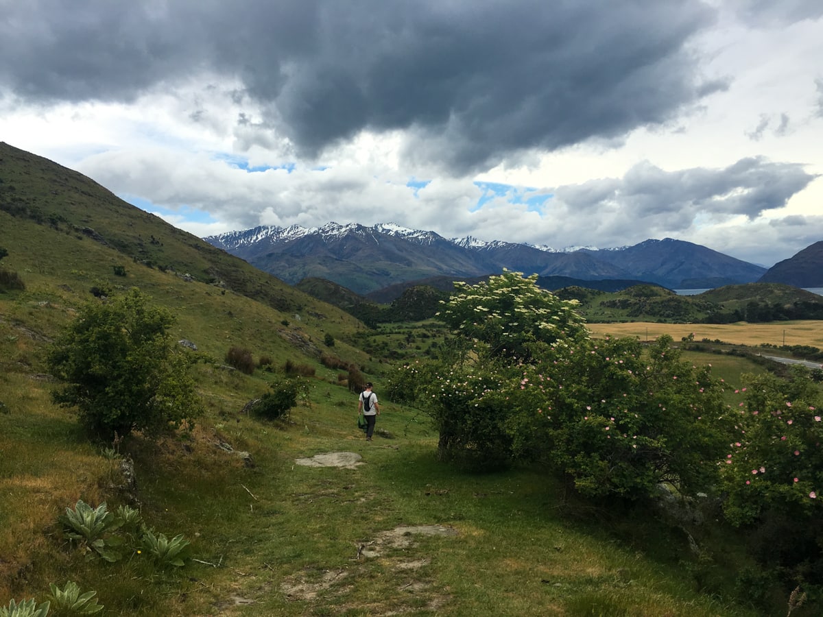
For those of you in California, Wanaka is like North Lake Tahoe but with a bit more of a town center and closer mountains. For Coloradans, it’s reminiscent of downtown Dillon (but fewer cars, less commercial space, and smaller feeling). For everyone else, it’s a beautiful ski destination in the winter, and a water- / extreme- / mountain-sports destination in the summer. So Elisse and I are kind of bound to like it, right?
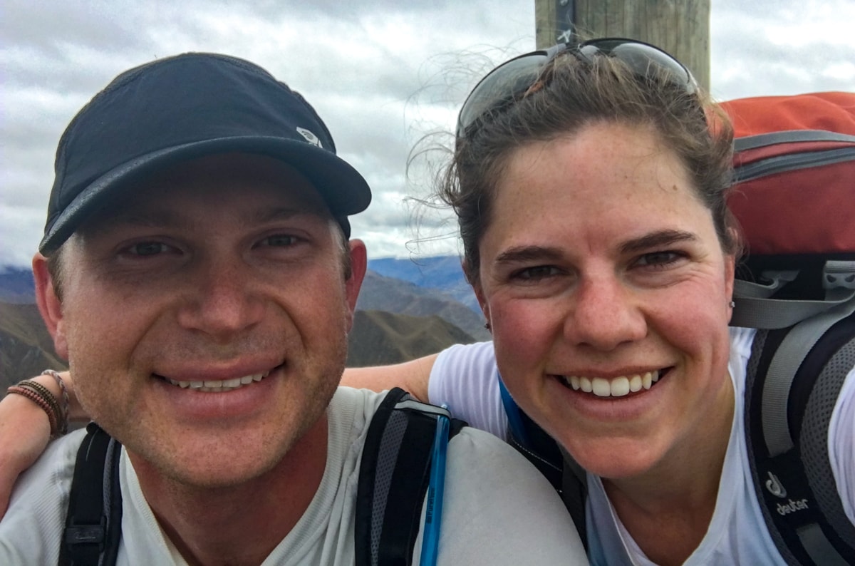
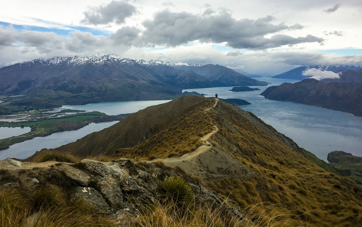
We did! And the hike we decided on for our first full day ended up being a nice contributing factor. Roys Peak is right outside town – we looked up at it from the bedroom window of our AirBnB – so it’s a popular trail, even on weekdays. We got started at 9ish, and were maybe the 6th car there. When we got back, that number had swelled to 40 or 50. Apparently the 1250m vertical ascent wasn’t frightening too many folks.
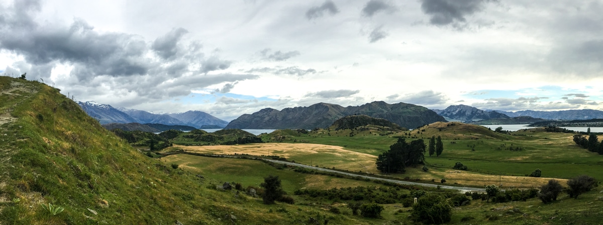
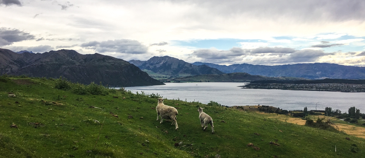
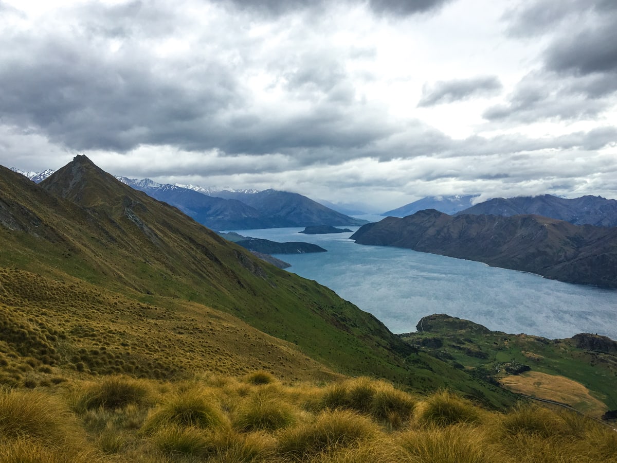
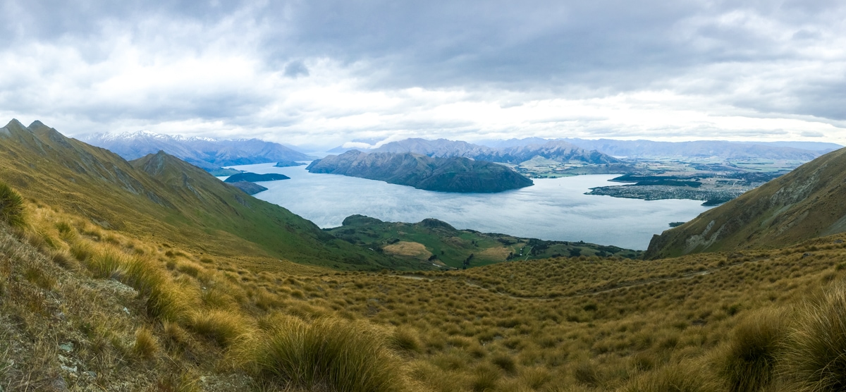
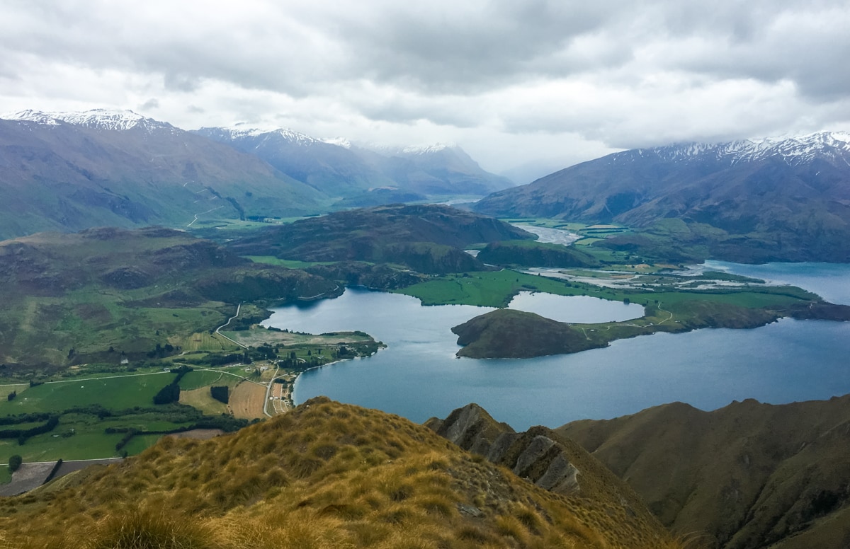
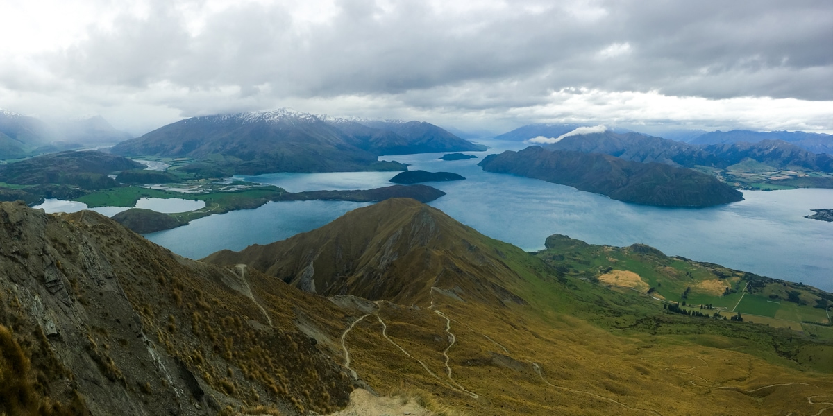
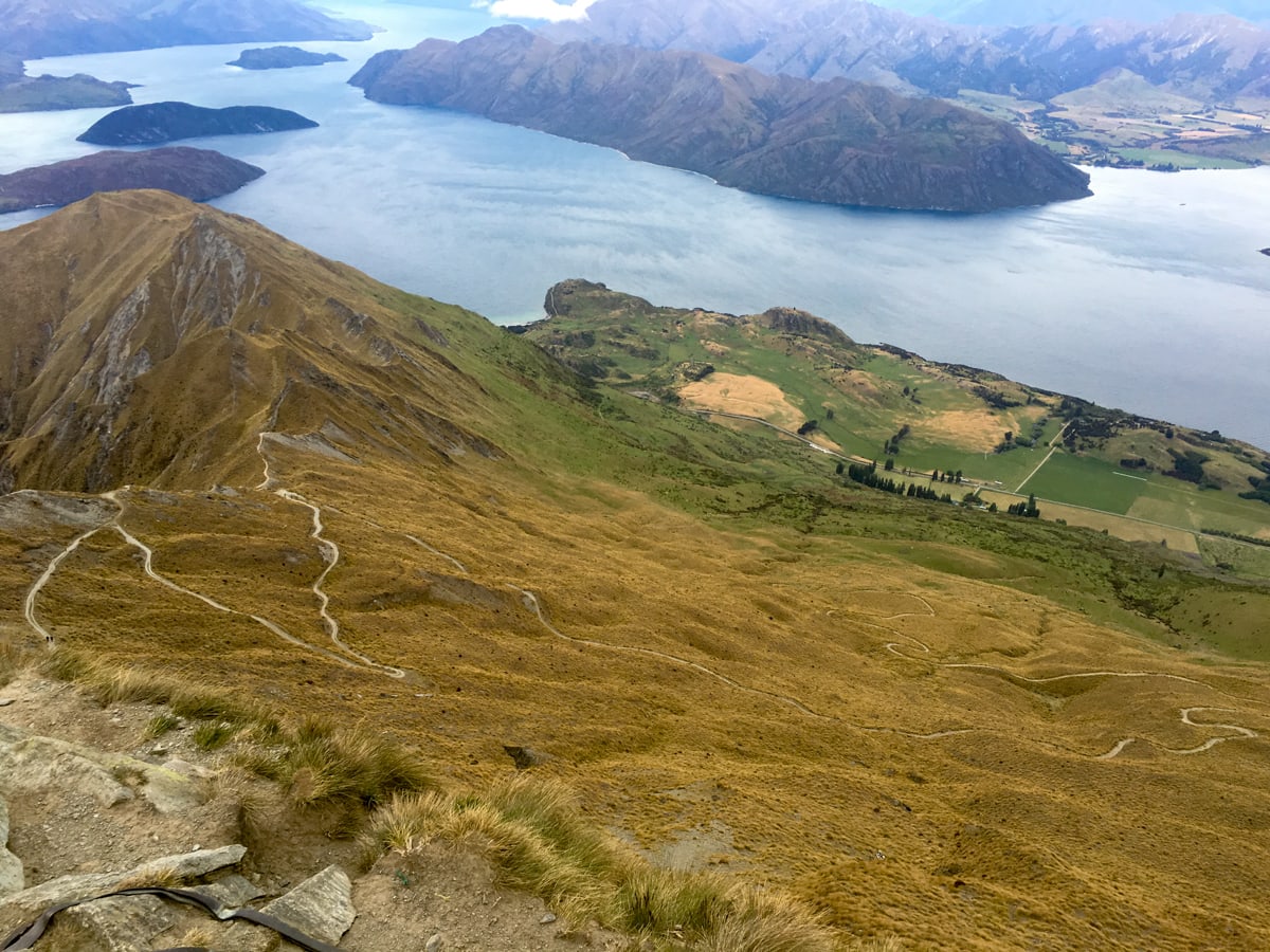
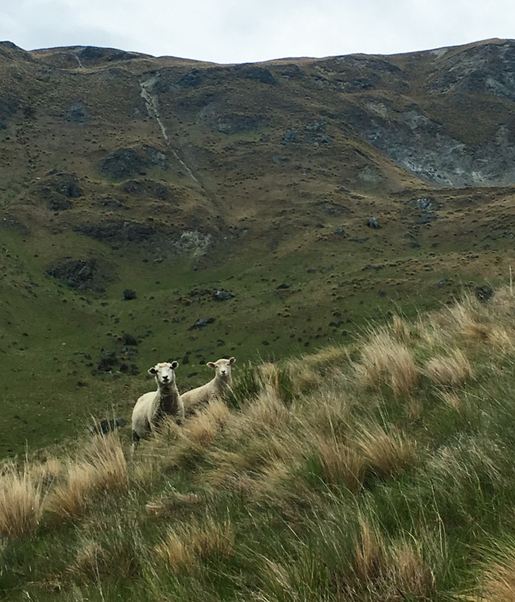
All in all though, the hike was very New Zealand-y. And by that I mean 1) we were walking through sheep pasture for the first 2/3 of the way, 2) the last 1/3 was a declared conservation area, 3) the trail was in fairly to very good condition the whole way and was easy to find, 4) everyone we met was really nice, and 5) the views were stunning the whole time.
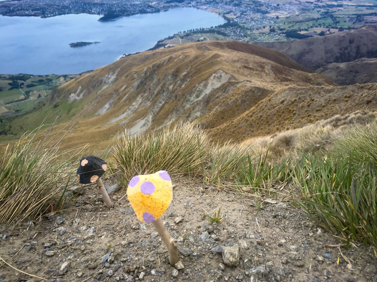
Lots more info in photograph captions:
And we're only getting started. Featuring Lake Wanaka in the background.Sheep! Lamb! Scenic lifestyle.Starting to see "the Peninsula" up from the lake on the right, and Roys Peninsula is jutting out from the left (yes, that dude got something else named after him). Check out the wind on the water!Panning right, full shot of the Peninsula with Wanaka starting to come into view. Immediately behind the Peninsula are Mts Burke, Gold, and Maude.The little Glendhu Bluff is in the left foreground (rising up from the left most water area), beside Glendhu, Parkins, and Paddock Bays. You can also see the Matukituki River making its way towards the Bays in the upper right of the photo. It's fed by 6 glaciers upstream, one of which is the Rob Roy Glacier. (Same Roy? Maybe.) The road that you can barely make out switch backing up the broad mountain face in the upper left takes you to Treble Cone ski area in the winter.Our route. The sheep like to stay in the green. Here you can easily make out two of Lake Wanaka's islands, Mou Tapu behind Roys Peninsula and Mou Wahu further back.We made it!It looks steep, but was heavily switchbacked, so it was ok, but it just took forever.Someone had 'planted' ceramic mushrooms on the top. Lol.Mt Aspiring is unfortunately hidden in the distant clouds here. Guess we'll be satisfied with this view in the meantime. Featuring Black Peak, Fog Peak, and Niger Peak on the left, and the Buchanan Peaks on the right.Hi!Descending through the spongy green grass trail.Scenic beer in town! Great way to end the day.
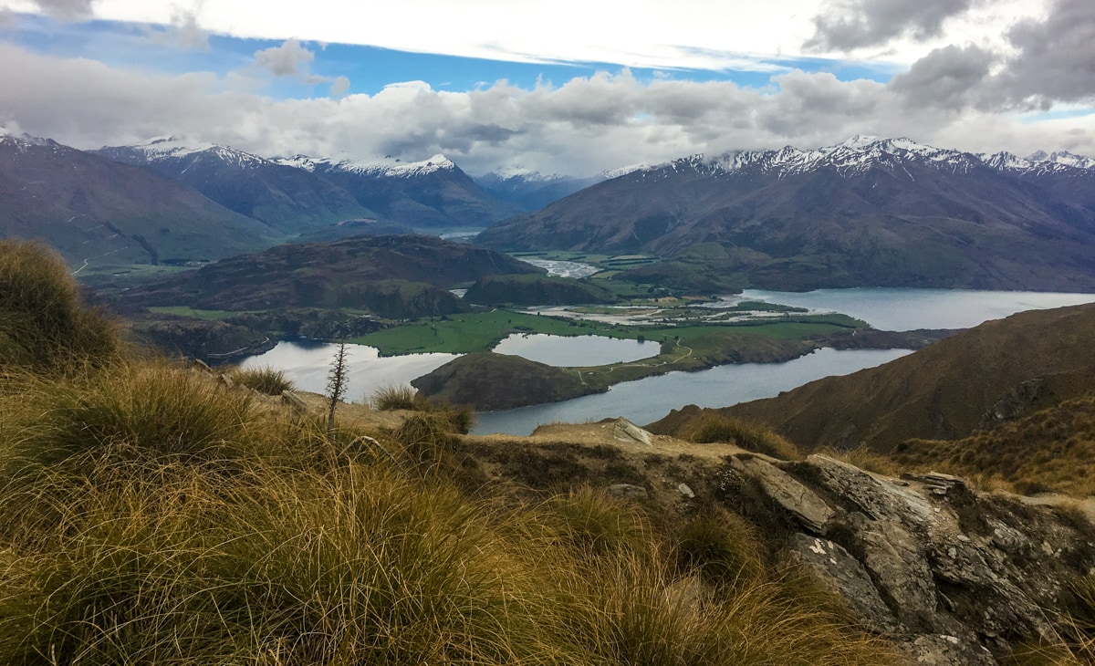
Check out http://www.topomap.co.nz/ for more geographic exploration. It’s excellent, and they have a great app too.
The cover to this post is my favorite photograph so far! wow!